Surrounded by rugged mountain peaks, citrus orchards and indigenous Fynbos flora, this Western Cape hamlet is a traditional farming settlement that offers a glimpse into typical rural South African life. Citrusdal is the perfect supply stop en route to the Cederberg or Koue Bokkeveld. It is home to inviting natural hot water springs. Located along the magical Cape Flower Route, Citrusdal's picturesque landscapes offer inviting natural hot water springs, scenic hiking trails, remote camping spots, and holiday chalets.


Rising from the beautiful Drakensberg Mountains in Lesotho, forming part of the international border between South Africa and Namibia, the Orange River is the longest river in South Africa. The Orange River Basin extends into Namibia and northern Botswana. The river snakes its way through one of Southern Africa’s harshest environments bringing life to an area of sheer rugged beauty. Aside from vineyards in the desert the river also creates a mobile playground from which to explore the area. This spectacular river created the diamond dune fields along Namibia's coast, by washing diamonds downstream from the Kimberly region over millions of years. Visitors can look forward to excellent whitewater rafting, canoeing, and kayaking, as well as wonderful river cruises which allow excellent views of the surroundings.


Encircled by dramatic, rust-coloured cliffs and arid plains in the southern reaches of Namibia's Fish River Canyon, Ai-Ais, which translates to "burning hot" in the Nama language, is renowned for its sulphurous hot springs. A single road runs through the town, flanked by comfortable lodges and campsites designed for adventurous visitors. At the heart of Ai-Ais lies the iconic Hot Springs Resort, where steaming sulphurous pools invite travellers to relax following a thrilling hike down the Fish River Canyon Trail or to simply enjoy a scenic soak under the expansive Namibian sky.


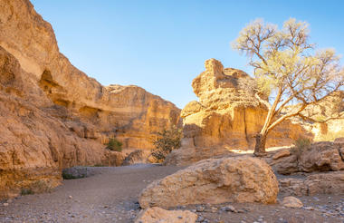
As there is no accommodation at Sossusvlei, visitors to this desert wilderness are likely to end up staying at Sesriem, 65 kilometres away, where camps and lodges serve as a base from which to explore the dunes. Sesriem Canyon, a deep chasm carved through the rocks by water, is a striking natural feature of the area that is best explored on foot. Stony walls rise up sharply on both sides of the canyon, while birds roost in its crags and lizards dart along the ledges. The canyon’s name was coined when early settlers used it as a water source, using six lengths of leather (‘ses riem – six thongs) tied together to lower buckets into the water at the base of canyon.)
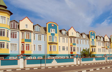
Set along Namibia's spectacularly scenic coast, the seaside town of Swakopmund is known for its wide-open avenues, colonial architecture, and its surrounding otherworldly desert terrain. Founded in 1892 as the main harbour for German South-West Africa, Swakopmund is often described as being more German than Germany. Now a seaside resort town, Swakopmund is the capital of the Skeleton Coast tourism area and has plenty to keep visitors happy. The quirky mix of German and Namibian influences, adventure options, laid-back atmosphere and cool sea breeze make it a very popular Namibian destination. Visitors can look forward to a number of exciting activities including: quad biking, horse riding, paragliding, fishing, sightseeing and fascinating desert tours.
Located in Namibia's Kunene region, the city of Outjo is known as the gateway to Etosha. Outjo’s central position also makes it an excellent stopover en route to the Skeleton Coast and Damaraland, but that’s not the only reason to visit this small town. Set amidst rolling hills, Outjo is a charming getaway boasting attractive forest and savannah surrounds, friendly locals and several historical sites. Roughly an hour’s drive to the west you will find the Ugab Rock Finger, a 35-metre high stone monolith, while slightly further on is a 250-million-year-old petrified forest. Visitors can look forward to a variety of interesting sights including: visiting the local Franke Haus Museum, for a historical account of the area; and exploring the nearby Hopewell Farm to find magnificent volcanic tiger's eye deposits.
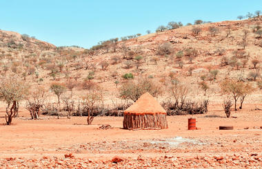
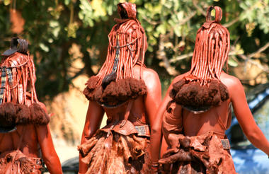
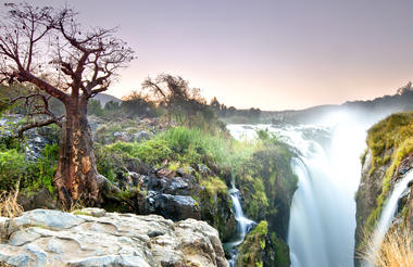
Opuwo, meaning 'the end' in Herero, lies in the north western Kunene region of Namibia. It serves as the capital of the region and is known as the gateway to the magnificent Epupa Falls. The surrounding landscape is characterised by low-lying hills, and vast dry desert plains inhabited by a wealth of desert-adapted wildlife. It serves as the central hub for the Himba culture. The town provides a perfect base for visitors wishing to explore the Kaokoland area and visit the local villages of the itinerant Himba people. The town and the Opuwo surrounding area is known as one of the cultural highlights of a trip to Namibia as it features an incredibly rich cultural heritage. Don’t miss an opportunity to learn about the fascinating Himba community within this starkly beautiful landscape.
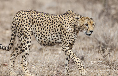
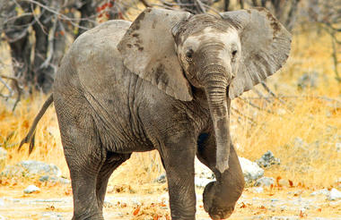
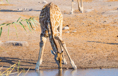
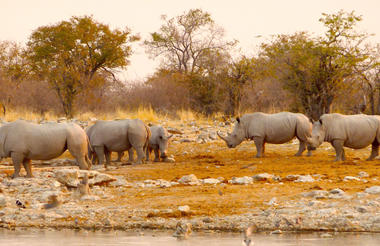
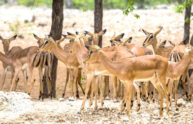
Located just south of the boundary of Etosha National Park in northwestern Namibia, Etosha South makes up the southern region of this wild paradise. The area is comprised of a collection of world class private game reserves. The national park can be accessed via the southern entrance at Andersson’s Gate. Visitors can catch a glimpse of a variety of wildlife including: lion, giraffe, elephant, white and black rhino, and a multitude of plains game. Popular activities include: enjoying an open 4x4 safari with an expert guide, half day or full day drives with the option of a picnic lunch with wine on the full day game drive.