


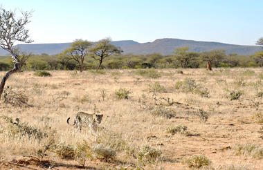
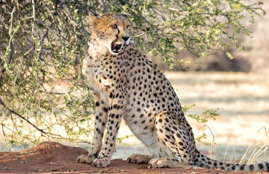
Midway between the spectacular Etosha National Park and the capital city of Windhoek, lies the well-known Okonjima Nature Reserve. The 22 000 hectare nature reserve is home to AfriCAT, a carnivore sanctuary, which gives the captive cats a second chance to be released back into the wild and become completely independent hunters in a protected area right in the middle of commercial cattle farmland. Visitors can enjoy a stay at a variety of excellent accommodation options including everything from luxury villas to secluded camping. Don't miss the opportunity to enjoy thrilling cat-tracking guided safaris, leopard-spotting, off-road night drives and learn about local San culture along the Bushmen trail.
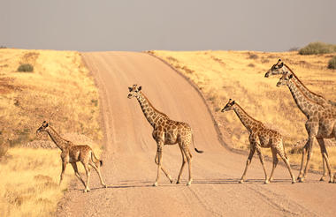
Located in north-western Namibia, Etosha East is a protected sanctuary in the eastern part of the world-renowned Etosha National Park, known as one of the most accessible game reserves in Southern Africa. Etosha East boasts vast open plains scattered with semi-arid savannah grasslands dotted with watering holes and secluded bush camps. An impressive 5000-square-kilometre Etosha salt pan makes up a large area of the eastern side of the park and can even be seen from space. This remote area teems with abundant wildlife such as lions, elephants, black rhinos and giraffes, as well as a variety of birdlife featuring flamingos, ostriches, eagles, hornbills, and owls.
The pan is subject to periodic, partial flooding during the rainy season. Direct rainfall accounts for only a small proportion of the pan’s water; three rivers supply the majority: the Ekuma, Oshigambo, and Omuramba Ovambo. The Ekuma River flows seasonally from the southern shores of Lake Oponono, situated about 70 km north of the pan. This lake receives input from numerous perennial watercourses and osahnas (linearly-linked, shallow, parallel lakes), the Cuvelai River being the most important (Berry et al. 1973). The Oshigambo River draws its water from southern Angola. The Ekuma and Oshigambo Rivers form deltas in the northwestern corner of the pan, about 13 km apart. The Omuamba Ovambo River receives its water from a catchment to the northeast of Etosha, and it flows into the pan through Fisher’s Pan, a small eastern extension of the main pan body. All three rivers flow erratically during the rainy season and, depending on their levels, flood the pan to varying degrees. In unusually dry years, the rivers may not flow at all, forming a series of disconnected pools. During these dry years, the pan holds direct rainfall only. The pan does, however, usually hold some water for a few months between January and April. Once in about 7-10 years, during exceptional rains, the oshonas and rivers fill with rainwater and sometimes with floodwater from the perennial Cuvelai River in Angola. This water reaches the pan, transforming it into a shallow lake holding large sheets of water, usually not exceeding one meter in depth. The water in the pan is, however, unfit for animal consumption as the salt content is often double that of sea water (Balfour and Balfour 1992).


One of the largest national parks in Africa, one of the oldest and is Namibia’s number-one tourist destination. Etosha National Park is home to 114 large and small mammal species, more than 400 recorded bird species, scores of reptiles and even a fish species. Etosha is the country’s flagship park. The size of the park has been reduced considerably since it was first proclaimed in 1907, but it still remains larger than several European countries.
The Oshindonga name for the pan was Etotha, meaning ‘the place where no plants grow’, but early European traders, unable to pronounce the name, called it ‘Etosha’. The pan was once part of the massive Lake Kunene fed by the Kunene River, which at some time in the distant past dried up, leaving the current pan system. Newly excavated fossils belonging to marsh-dwelling antelopes such as sitatunga, lechwe and tsessebe, and a 90- cm long catfish, are testament to much wetter periods.
Etosha has a proud record of black-rhino conservation, and white rhino were recently re-introduced. The park has also played a major role in the recovery of the endemic black- faced impala. The Etosha Ecological Research Institute attracts scientists from around the world.
Etosha’s waterholes are famous among international tourists for spectacular game viewing and at the Okaukuejo waterhole at night it is possible to see black rhino, lion and elephant.


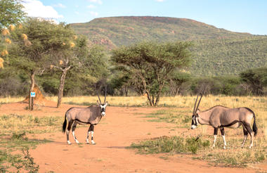
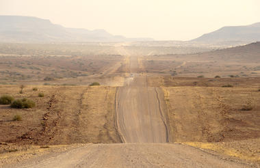
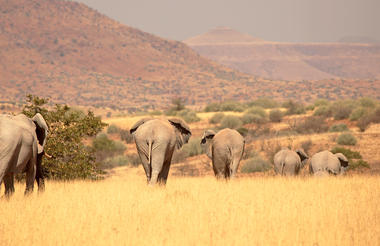
Palmwag is a nature reserve idyllically located along a palm-lined tributary of the Uniab River, halfway between Swakopmund and Etosha, providing an ideal base from which to see the sights of the Kunene region or embark on one of the many local hiking trails. Water is scarce in this area, so the river’s presence often lures elephants closer to the camps. The reserve is notable for its unusual species of palm tree, the hyphaene petersiana, and for being home to the largest population of southwestern black rhinos in Africa. Animal lovers can also get a peek at leopard, lion, cheetah, mountain zebra, Angolan giraffe, springbok, kudu, and African bush elephant.
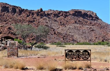
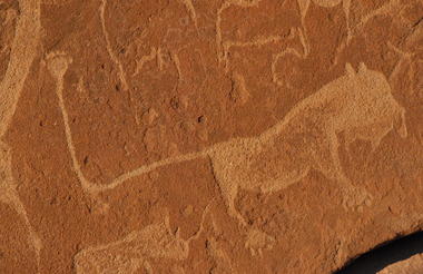
Set in the Kunene Region of north-western Namibia, Twyfelfontein is a spectacularly scenic area, featuring one of the largest and most important concentrations of rock art in Africa. The name ‘Twyfelfontein’ translates to ‘Fountain of Doubt’, which refers to the perennial spring situated in the impressive Huab Valley flanked by the slopes of a sandstone table mountain. It was this spring that attracted Stone Age hunters over six thousand years ago, and it was during this time that the extensive group of rock engravings and paintings were produced. Visitors can look forward to basing themselves at some wonderfully shady campsites along the Aba-Huab riverbed, while exploring over thirty different sacred ritual sites of the traditional hunter-gatherer communities.

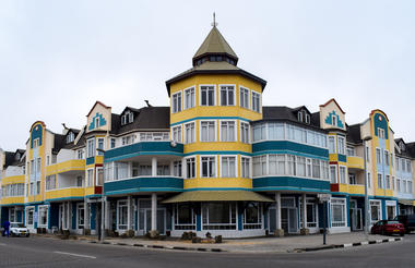
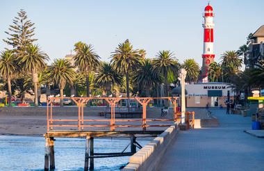
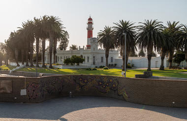
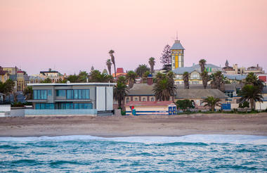
Set along Namibia's spectacularly scenic coast, the seaside town of Swakopmund is known for its wide-open avenues, colonial architecture, and its surrounding otherworldly desert terrain. Founded in 1892 as the main harbour for German South West Africa, Swakopmund is often described as being more German than Germany. Quaint architecture from a bygone era adds to the time-out-of-place atmosphere of Swakopmund.
The architecture of the town, wedged between the desert and the ocean is redolent of its German colonial past. But Swakopmund has a relaxed atmosphere with pleasant promenades, palm trees and gardens and there is plenty to do here.
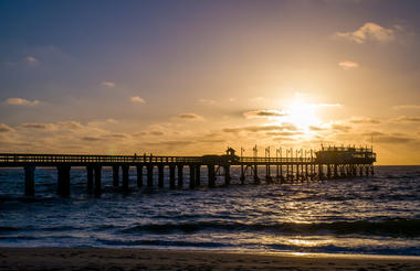
Now a seaside resort town, Swakopmund is the capital of the Skeleton Coast tourism area and has plenty to keep visitors happy. The quirky mix of German and Namibian influences, adventure options, laid-back atmosphere and cool sea breeze make it a very popular Namibian destination. Visitors can look forward to a number of exciting activities including: quad biking, horse riding, paragliding, fishing, sightseeing and fascinating desert tours.

As previously described
As there is no accommodation at Sossusvlei, visitors to this desert wilderness are likely to end up staying at Sesriem, 65 kilometres away, where camps and lodges serve as a base from which to explore the dunes. Sesriem Canyon, a deep chasm carved through the rocks by water, is a striking natural feature of the area that is best explored on foot. Stony walls rise up sharply on both sides of the canyon, while birds roost in its crags and lizards dart along the ledges. The canyon’s name was coined when early settlers used it as a water source, using six lengths of leather (‘ses riem – six thongs) tied together to lower buckets into the water at the base of canyon.)


