

SALTA - CAFAYATE 197 km - 3 hour 20 min drive
Type of road: paved.
Altitude Salta: 1152 m / Cafayate: 1680 m.
Welcome to Salta!!! Upon arrival at the airport you will pick up your car to start your trip to Cafayate, your today's final destination.
After 46.6kms drive along Route # 68 you will reach the village of Coronel Moldes. At this point you can turn left towards Provincial Route # 47 following the signs “Dique Cabra Corral” and drive 5.7kms to reach the lake and the impressive dam, named after the title used on the folders of the project by the American company in charge of the topographic surveys. “Cabra Corral” instead of “Corral de Cabras” as the area was truly called (“goat yard” in English). Once you've visited the dam you drive back to Coronel Moldes and turn left on Route # 68 towards Cafayate.
You will pass by small villages like Ampascachi, La Viña, Talapampa & Alemania before starting your journey along the “Quebrada de las Cochas” (Las Conchas River Ravine), declared Natural Monument by UNESCO.
The Las Conchas River Ravine begins to show you the tracks left by the wind, which eroded and gave shape to the mountains of unique colors as if they were leaves, easy to manipulate. Winds from time immemorial have visited them long before man did.
As the road begins to narrow down and get surrounded by high walls, going from one side to the other along the ravine, you will observe many strange rock formations, some of which deserve a stop:
“The Devil’s Throat” is the first tourist attraction the wind carved in this area. This is a real hole in the mountain wall which lets us behold a kind of roofless cavern. As amazing as the echo of our voices projecting into the hollowness.
Following the road, “The Amphitheater” appears. A beautiful place where the wind has also managed to go through the stone and give shape to a unique site where it is possible to watch the magic of nature from the first row.
“The Obelisk” is the next surprising geographical feature on the way. This is a small sharp-pointed mountain whose summit is about fifty meters high. Its eroded top catches the tourists’ attention as it resembles the mythical obelisk from the City of Buenos Aires, but with a particular idiosyncrasy this time, carved in stone by nature.
A few meters ahead, on the right, it is possible to see large rock and terra cota constructions resembling medieval castles, with majestic openings and watching towers. At their base, the placid river rests just like the ancient moat waters around real-life castles.
“The Toad” is another attractive natural figure on the way. This is a grotesque solid rock which catches the attention of motorists from several hundred meters away. A toad is the first thing to be seen, sitting with its legs pointing ahead, its large mouth and eyes lost up in the sky.
Some kilometers ahead, the mountains seem to fall abruptly into the river, as if they were announcing a noise that could not be silenced. There comes “The Friar”, a rocky formation which, from the heights, seems to summon everyone to attend mass.
Farther ahead, stand “The Windows”, one of the last formations visitors can run across before reaching beautiful Cafayate. They let us see the large white sandhills sprinkled with green vineyards or the Colorado River with just a thread of water along the reddish and clayish soil. The road has lost height and a long straight line turns into a fertile valley called Cafayate.
After a breath taking journey along National Road # 68 and Las Conchas River Ravine you will notice the vineyards of Cafayate start to appear at both sides of the road. You will notice El Esteco Winery on the left that indicates you are entering Cafayate City limits.
Some meters ahead turn left on legendary National Route # 40 that will lead you to the city center. Make sure to fill the tank at the YPF Oil Station before taking your way to your hotel.
Sweet dreams!


CAFAYATE - Altitude 1680m
Today is at your leisure to enjoy the city and its surrounding vineyards.
About Cafayate
Located at 1,680 m above sea level, Cafayate is well known because of its famous torrontes wine product of the exquisite combination of temperature and humidity that provides the ideal environment to the growth of the sweet and deep fruit flavor.
Getting to know its streets, its houses and mainly its people is a pleasant experience due to the fact that tourism is an important activity for the town. One cannot miss to observe the unique architecture of the Cathedral, the flowery main square, the picturesque stone mill or the wine museums.
The wineries located downtown offer visitors the chance to taste their best varietals as they enhance their knowledge about winemaking. These are three wineries close to the main square: Bodegas Nanni, Bodegas El Tránsito and Bodegas Domingo Hermanos.
Bear in mind: The period going from February to April -the vintage season– is the best time to watch the process of winemaking. Admittance to the wineries is free of charge, whereas visitors may stay at accommodation venues throughout the circuit at the various cities or towns, as well as in the wineries themselves, which are specially conditioned to welcome guests.
Other wineries to visit in the surroundings
Yacochuya Winery
Yancochuya red wines, which grow over 2,000 m high in the Calchaquíes Valleys, have become a typical exponent of Argentinian enology in a few years.
El Esteco Winery, Premium Wines
This guided tour around one of the emblematic wineries in Cafayate is an excellent occasion to broaden our knowledge and taste boutique Argentinian wine.
Piatelli Winery
Offering spectacular views of Cafayate and the Calchaqui Valleys, Piatelli offers Premium wine tasting and a terrace restaurant serving delicious local dishes


CAFAYATE - MOLINOS - CACHI - 162km - 4 h drive
Type of road: parcially paved
Altitude Cafayate: 1680 m - Cachi: 2280 m
About the legendary Route 40 from Cafayate to Cachi
The stretch of National Route 40 that joins the traditional towns of Cafayate and Cachi boasts the Calchaquí Valleys and dazzles travelers with its imposing views full of color.
About 16kms out from Cafayate, some districts with a history lay ahead. The latter date back from the times in which the Spanish settled down in northern Argentina and were later on joined by the Jesuit missions, which established churches and buildings that still remain.
Animaná, San Carlos, Angastaco, Molinos and Seclantás are the outstanding hamlets on this worthy winding road, featuring parts made of gravel, sand and dirt. As you find these dormant settlements, catch a glimpse of their architecture with details such as roofed galleries.
Let yourself be tempted by regional jams and craft wines sold by the locals at every corner.
All along the twenty kilometers that lie between San Carlos and Angastaco, you will enjoy the rock outcrops with a strange slant known as Quebrada de las Flechas to both sides of the road. You will be impressed by the way the movements of the ground and the erosion of the winds shaped the mountains made of sandstone of changing hues into a strange scene that ranges from gray to reddish ocher tones.
Molinos is worth a visit. A picturesque town founded in the mid-17th century.
The town conserves old adobe houses with galleries and porticoes and outstanding buildings such as the San Pedro Nolasco Church built in 1639 and in front of it, the Casa – Hacienda de Molinos that gave rise to the population and where the Molinos Hosteria operates today. Take some time for a drink at the patio and relax…
Next village is Seclantás, where the best cloth-making artisans live, the local families love to show the traditional red and black ponchos from the province, as well as other woven items, hung in their yards next to the loom. This skill has been passed onto them by their elders.
Cachi will welcome you with its typical quiet mood, cobbled streets and adobe houses by the Calchaqui River.
- Once you enter Cachi city limits you will notice a YPF Oil Station on your left.
- Your hotel "La Merced del Alto" is located at a satelite village called Cachi Adentro, 2,5kms from the YPF Oil Station.


CACHI - SALTA - 157 km - 3 h 10 min drive
Type of road: paved
Altitude: Cachi: 2280 m – Piedra del Molino 3348 m - Salta 1152m
After breakfast, check-out and take your time to visit Cachi .
Cachi is a beautiful town in the Chalchaquí Valleys of Salta located on the east slope of "Cachi snowcapped Mount"( 6,720m ) at 2,280 m above sea level.
In this legendary town, there are white buildings, adobe houses, paved streets and impressive architectural and cultural constructions that make the tourist admire and contemplate the scene.
In this region of the country the climate is warm or cold and dry with Summers registering temperatures ranging from 15 to 28º C and Winters with temperatures ranging from 1 to 19º C. The land is mainly arid but fertile to grow vegetables, legumes and , especially , peppers.
Cachi means " salt" in quechua due to the fact that natives mistook the top of " El Nevado" (Snowcapped mount) with a salt mine.
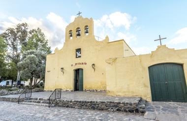
The most outstanding places to visit are the Archeological Museum, Cachi Church and Antigales, where you will find deposits of old native civilizations.
Take Route # 40 to get out of the village, cross the bridge over the Calchaqui River and continue along Route # 40 for 11.4km to reach “Payogasta”. After passing by the village turn right towards Route # 33 following that will lead you to your next destination: SALTA
22 kms ahead of Payogasta you will find Los Cardones National Park.
Between cactuses and flowers of Amancay, Los Cardones National Park lies in a huge area of 65,520 hectares, 100 km away from Salta. This natural reserve was created in 1996, together with the jungle jewels of El Rey and Baritú, in order to protect an admirable area that encompasses four different natural environments, mainly the dry mountains and ravines, between 2,700 and 5,000 meters high. There the predominant shrub formation of the pre-puna predominates, in addition to typical communities of the mountains and the high Andes.
The "cardón" or thistle, column-like cactus plant that exists in areas 3400 m (11,152 ft) in altitude, is the symbolic species of this National Park.
The altitude gradient of this region makes for a largely diverse environment that allows an appreciable variety of animals to exist in such a desert-like area. There have been more than 100 species of birds detected, a few that deserve recognition are the inambu serrano, quiula puneña, and the aguilucho puneño (eaglet of the puna region), among others. These birds are typical of Argentina. Other kinds of animals include the vicuña and the northern guemul, whose populations have declined dangerously in Argentina.
Continue along The Tin Tin Straight Line, the straight path that crosses Los Cardones National Park, being one of the most beautiful scenes in northern Argentina
About the Tin Tin Straight Line
It looks out of this world, as if taken from a science fiction story. The desert of cacti takes hold of the scene where these hundred-year-old lookouts that multiply into dozens of thousands have seen everything. The whole view is covered by them and they spread even beyond the horizon.
Standing still with their strange and unparalleled arms in the air, they are looking at a perfect line that -according to anthropological and historiographical studies- was built by hand by the first nations dwelling in the area.
This line has come to be known as the Tin Tin Straight line and it consists in a path that crosses Los Cardones National Park, a desert teeming with cacti and cardons that was declared protected area in order to preserve these species through time.
Featuring fearsome thorns, insignificant spines and all kinds of green hues, the cacti or cardons are not all the same. There are many different families. As visitors come close to them, they can easily notice the variations in shapes, sizes, number of arms and shades. Every specimen is unequaled.
For years, cacti have been used as food and water source both by animals and by the human beings that have inhabited this region since time immemorial. That may be the reason why they are worshipped and respected as sacred symbols.
After the Tin Tin Straight Line you will start to climb up the “Cuesta del Obispo” (Bishop's Slope) on a 30 km drive to the top of the slope, known as "Piedra del Molino" (Millstone) 3348 meters above sea level, where lies a chapel raised to honor the Archangel Raphael, "Patron Saint of Travelers". This spot features an unforgettable view of the endless slope, which gets mingled with the granite formation of feldspar, mica and quartz contained in the area.
The next 69 kilometers will be down through the Escoipe Ravine The local vegetation is typical of the montane rain forest, with the presence of hydrophile and xerofile plants. Ancient laurels, willows, walnuts, peachtrees, poplars and some conifers are always present in the area.
Some kilometers ahead you may see from the vehicle terraces or platforms planted with corn, oats, peas or beans on the slopes of the hills located to both sides of the road. You are approaching Chicoana and El Carril villages.
Once at El Carril you must turn left towards 20 de febrero street (Route 68) that will lead you back to Salta. Upon arrival at your hotel, check-in and relax.


SALTA - AIRPORT
Enjoy breakfast at your hotel and take a time to visit Salta's main attractions: the High Mountain Archaeological Museum (MAAM) which features three Inca mummy children that were discovered
in 1999 in the ancient Inca civilization of Llullaillaco, the third highest active volcano in the world.
Its main churches and historical monuments: Old Cabildo (Town Hall), Cathedral, San Francisco Church, San Bernardo Convent and -time allowing- take the chairlift for a great panoramic view from San Bernardo Hill.
At scheduled time drop off the car at the rental office at the airport.
