Namib-Naukluft Park
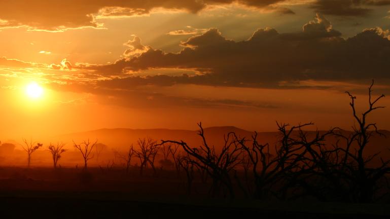
The Sossusvlei area is considered the heart of the Namib Naukluft Park, and area nearly 2 ½ times bigger than the Etosha National Park. Established in 1979 the park with its 50,000 km² is the country's largest natural park. The park lies between the Koichab Pan in the south (the area just north of the B4 between Lüderitz - Keetmanshoop) and the Swakoptal to the north. Scenic highlights are without doubt the Sesriem and Sossusvlei. Particularly the interior of the country, is subject to extreme temperature fluctuations, ranging between minus degrees at night and of over 30 degrees (in the winter dry season) and records of over 42 degrees in summer. The annual precipitation ranges between 10 and 90 mm, and often only manifests in form of mist. Proper rain is sporadic and very rare. Three rivers lead from the mountain cluster into the west of the Namib: the northern Tsondab, which flows into the Tsondab Vlei, the Tsams, which ends in the Tsams-Vlei, and the southern Tsauchab, which flows into Sossusvlei.
Sesriem Canyon
When rain falls in the Naukluft Mountains, the Tsauchab, normally a dry river bed, develops into a fast-running river within a matter of hours. It has, over the past two million years carved out Sesriem Canyon, a kilometre long and up to 30-meter deep canyon in sedimentary rock. The name Sesriem is Afrikaans and means "six belts", since the early settlers had to attach together six belts in order to reach buckets down into the canyon to scoop up water.
Sossusvlei – Important Information
Sossusvlei is a huge clay pan surrounded by massive dunes in the heart of the Namib-Naukluft National Park. Some dunes surrounding the Vlei reach heights of more than 250 metres.
Visitor tip:
We recommend an early morning visit to avoid the heat, and also to witness the play of light of the rising sun upon the dunes.
Upon request, the surrounding lodges will pack a picnic breakfast or lunch.
Visitors should remember to wear sun-block and stay hydrated.
There is a nominal entrance fee to be paid at the Sesriem Gate
The excursion can take up to 5 hours
The last 5 km to the Sossusvlei is only accessible by 4 wheel drive. Visitors can park their vehicle at the parking bay and take a transfer for a nominal fee.
Elim Dune
This picturesque large dune is only 5 km from the entrance at Sesriem and is a popular place for sunset trips.
Sossuspoort Viewpoint
From here you can see the wide valley of the Tsauchab river and enjoy a beautiful view of the dunes and mountains.
Dune 45
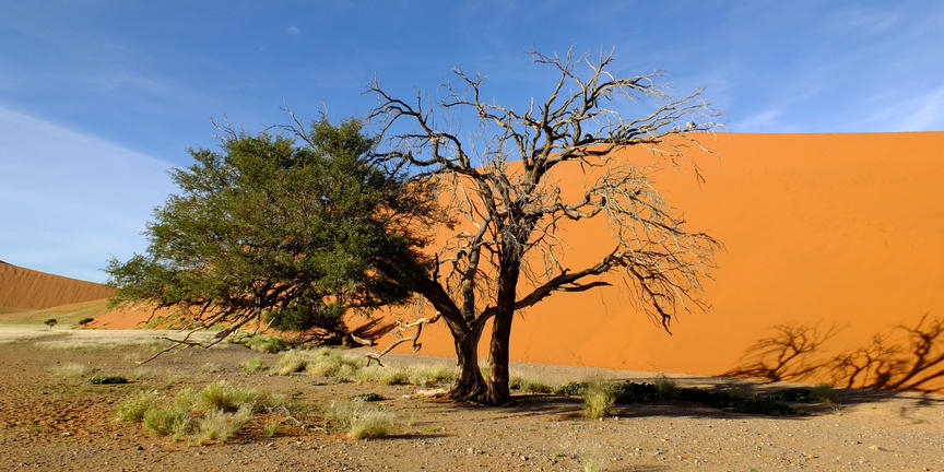
This 170 meter high, beautifully shaped dune is a mere 45 kilometres from the entrance to the area. Hence the name and so one of the most photographed dunes in the area.
Dead Vlei
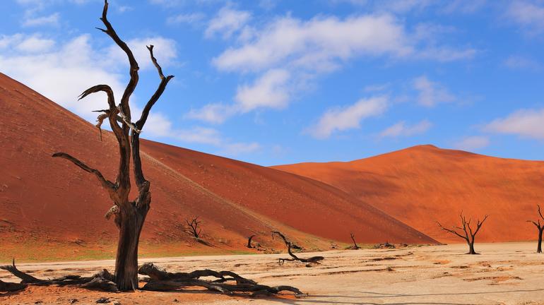
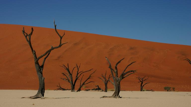
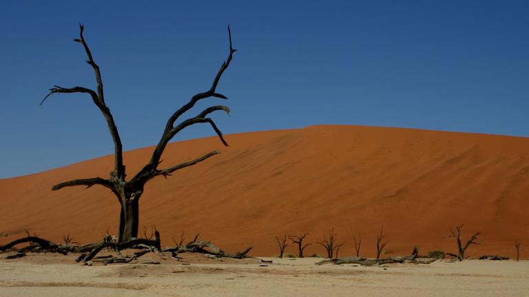
This clay area adorned with its bizarre and arid trees is said to be the remains of the Tsauchab River, which is assumed to have flowed all the way into the Atlantic ocean a mere 50 kilometres away. The highest of the surrounding dunes has been nicknamed “Big Daddy” and is estimated to be 300 meters high.
Sossusvlei
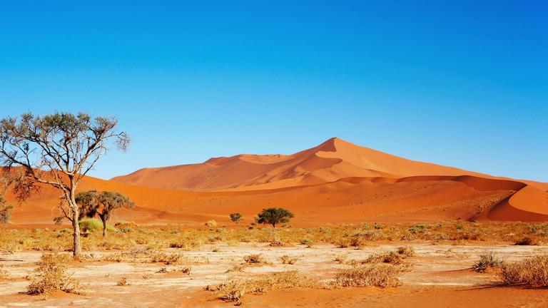
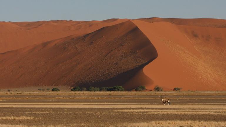
Since 21 June 2013, the Sossusvlei is part of the UNESCO World Heritage Sites. The orange colour of the sand is caused by iron oxide. With up to 380 meters difference in altitude, the dunes are among the highest in the world. Due to good rains in the area sometimes, the Tsauchab River can carry water in a short time to the end of the Vlei and creates a several meters deep lake. In the Nama language “Sossus” translates to “blind river” and even in the dry season several Oryx, Springboks and Ostriches are spotted in the area. Especially in the morning and late afternoon sun the colour and the shadows of the dunes create a fascinating spectacle. From an aerial perspective more valleys can be seen, separated by vast dunes.
The Naukluft Mountains
With the mountains highest elevations reaching 1949 m above sea level, this is not something to be missed. The mountain range lies in the triangle formed by the C14 Road (Maltahöhe - Solitaire), the C36 Road (Solitaire - Sossusvlei) and the D854. Compared to the surrounding area, the area receives relatively good rain in form of thunderstorms from December to April and can lead to extreme temperature drops to below 0 degrees.
Hiking in the Naukluft Mountains
Kindly note the following:
· Take plenty of water and provisions.
· Head cover and sun cream as protection from the intense sun.
· Good footwear is mandatory. The paths are rocky and partly very steep.
· Take a jacket and a flashlight in case of emergencies.
· Be sure to schedule enough time. The park closes at a specific time for visitors.
Waterkloof Hiking Trail
This 17 km long circular route lasts about six hours. Managed by the Ministry of Environment the trail follows counter clockwise upstream and then reaches its highest point at circa 1910 meters. The way down follows through the Naukluft gorge back to the state owned camping site.
Olive Trail
This hiking trail also starts near the state owned campsite and is about 10 kilometres long. After a steep ascent, where you will find some wild olive trees, one reaches the plateau and can enjoy a wonderful view. The descent through a valley and rocky fields leads to a waterfall that needs to be crossed with the help of a chain anchoring.
